Mountain Pass Cycling and Volcano Hiking Tour: to climb Mountain Passes in Ecuador, Andes
in June, July, 2026
I am going to rent a car and travel to the foot of the climb.Then I am climbing the mountain pass / climb / destination by bicycle, after descending. I must climb only 10-11 out of the listed ones below.
 Ecuador 's official currency USD !!
https://www.holiday-weather.com/quito/averages/
Quito 7-18 C best months June, July, August
https://www.weather2travel.com/chile/valparaiso/climate/#june https://freedombikerental.com/en/contact , info@FreedomBikeRental.com
-0.180944,-78.480907 , Specialized Rockhopper 29 , Daily: $20 | Weekly: $125 +15% tax
Ecuador 's official currency USD !!
https://www.holiday-weather.com/quito/averages/
Quito 7-18 C best months June, July, August
https://www.weather2travel.com/chile/valparaiso/climate/#june https://freedombikerental.com/en/contact , info@FreedomBikeRental.com
-0.180944,-78.480907 , Specialized Rockhopper 29 , Daily: $20 | Weekly: $125 +15% tax
Taller de Bicicletas cumbaya@tatoo.ws Lunes - sábado: 10h00 - 19h30
Domingos: 10h00 – 17h00 , Centro Comercial Villa Cumbayá Calle 1 s/n (detrás de Supermaxi).
Konzuli hivatal:Edificio MultiApoyo, Pedro Ponce Carrasco E9-25 y Avenida 6 de Diciembre
170517, Quito, https://konzinfo.mfa.gov.hu/utazasi-tanacsok-orszagonkent/ecuador#
Security alert:
Security in the provinces of Sucumbíos and Orellana in the Amazon region, bordering Colombia, and the canton of Camilo Ponce Enríquez in the Andean province of Azuay - remained in the II. security classification (orange), i.e. a category with a high security risk, recommended only for urgent travel. Guayaquil (SE) dangerous
Sucumbios, Ecuador Northeast dengue fever!
Day 1 in Quito June th
Renting a bicycle at , renting a car in
>> 16km, Booked rooms in
Day 2 Jan.14th
Acclimatization, just walking around, sightseeing by bicycle and a bit cycling. Tasting the high altitude!
Day 3 June th
Quito >>>North 85 km, 2,5 h driving
1942 - Bizochos
,Altitude 3114 m, GPS Location 0.13054 , -78.18355 top is before the roundabout / antes de la rotonda 3114 m , rotonda :0.133954, -78.185317, Rafael de la Laguna 0.193979, -78.231747 2700 m, DOL 414 m ,11,3 km
climbing route to Bizochos
3rd version Mirador Pisque 2400m, -0.002359, -78.306890 , 29 km DOL 714 m , Rd 282, 28B, 3 Claim
no official route yet !
-0.048232, -78.341799 , Guayllabamba 2100 m, 1014 m szintkülönbség , 28B úton 36,4 km
-0.048293, -78.341802 , 2180m Vía Guayllabamba Tabacundo 38 km Rd 282, 28B )
Santa Fe hostel, colon y sucre direccion principal, 100401 Otavalo 4-5 nights
Day 4 June th
>>8km from Rafael de la Laguna
(Quito >>> North 110km , 3 h driving)
1368 - Laguna Cuicocha
3104 ( Guinea Pig tengerimalac Lake ) , GPS Location 0.29283 , -78.35702 , SE 17.1 km - 538 pt , Otavalo , 2545m ,start location , 0.23272 , -78.26787, DOL 559m , 17.1 km, 3.3 -10.8 % , EP 538 , E 16.3 km - 533 pt Northeast side :
Quito >> North 100km, 2,6 h driving>N
Baños start altitude 1622m start location -1.398390 , -78.379470
DOL 1008m , 15.1 km , 6.7 -16 % EP 1032 , 8 Claims
Laguna Cuicocha climbing route
5.- 6.day
Quito >>> North >>> 100km 2,5 h driving
Hiking, climbing to Cotacachi volcano ?
Cotacachi is a dormant volcano in the Western Cordillera 4944 m
Informations about vulcano climbing in Ecuador or break day ?
An annual fiesta of San Juan, San Pedro, y San Pablo (also known as Inti Raymi, or the "Sun Festival" in Kichwa) in late June
>> 6.7 km
or break day / sighseeing in Otavalo ?
(Quito>>> North 92 km, 1,2 h driving) still in Otavalo
7. day
2157 - Via Otavalo - Selva Alegre
, 3447 m , 0.24879 , -78.42665 , Otavalo 2509m , 0.243490 , -78.261810
DOL 938m , 26.7 km , 3.5-8.9 % , EP 6822 Claims
Via Otavalo - Selva Alegre climbing route on bikemap.net
same starting pont! With Laguna Mojanda and Laguna Cuicocha
Plaza de los Ponchos, handycraft market on Saturdays ,indigenous group ( őslakosok)
San Antonio wood carving, Cotacachi leather , , Parque Condor, a bird rescue centre , Parque Bolívar , Edificio Municipal , Iglesia de San Luís ,Cascada de Peguche Waterfall ,
Imbabura Volcano 4609m, southern Ring of Fire. climbed from the town of La Esperanza or where the road ends about 4 km above it in the village of Chirihuasi. From Chirihuasi, the altitude gain is approximately 1,600 metres (5,200 ft). The route follows a ridge and reaches the false northern summit before contouring around the crater to the true summit.
, Travelling by train from Otavalo to Ibarra has become an important tourist attraction.
still in Otavalo
8. day
2372 - Laguna Mojanda
3735 m , 0.14115 , -78.27945 , N: Otavalo , 2544m , 0.23282 , -78.26784, DOL 1191m! , 15.7 km , 7.6 -13.1 % , EP 1152 4 Claims Climbing route to Laguna Mojanda on google maps
>> North >> 35 km,1 h driving
9. day/ July th
1367 - Pan America - Las Cajas
Altitude 3110 m , GPS Location 0.1326 , -78.1849, Restaurante El Paisa
starting point 0.033849, -78.253469, 2810m 21 km ,DOL:300 m no official route, 1 Claim
Pan America - Las Cajas climbing route on openstreet map
Pan America-Las Cajas climbing route on google map
Day 10 June th
>> Northeast>>>>30 km , 1 h drrivnig Imbabura volcano 4609 m climbing ?
https://runatupari.com/en/tours/climbing-imbabura-volcano/
>>>South>>> 100 km; 2,5 h driving
2151 - Panecillo
2999 m in Quito! , -0.22849 , -78.51845 , Hacienda San Carlos ,start altitude , 2274m ,start location -0.211550 , -78.423210 , DOL 725m , 18.6 km , 3.9 %-11.5 % , Energy points 623
Panecillo climbing route
Quito
Day 11 June th
>> 95 km 2,5 h driving
2151 - Panecillo
2999 m in Quito! , -0.22849 , -78.51845 , Hacienda San Carlos ,start altitude , 2274m ,start location -0.211550 , -78.423210 , DOL 725m , 18.6 km , 3.9 %-11.5 % , Energy points 623
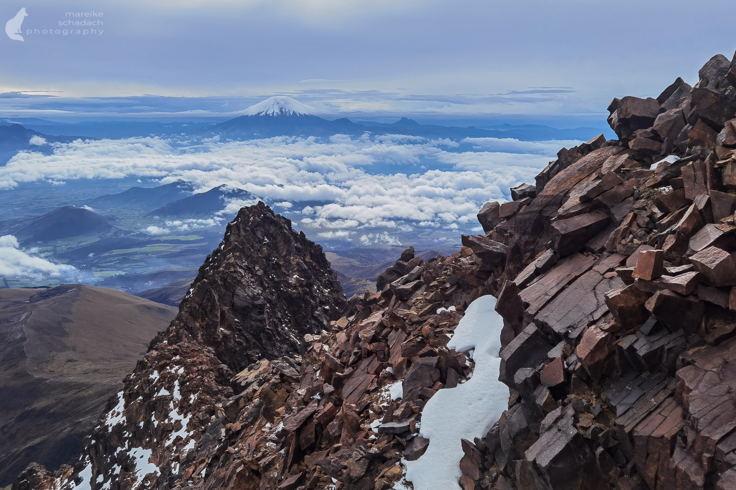
Panecillo climbing route >>> pic:Illiniza Norte
5126 m climbing route from Machachi
Day 12/ June th
2374 - Antenas Pichincha
3874 m , -0.16775 , -78.52534 , NE : Quito 2923m -0.17483 , -78.50201 , DOL : 951m , 12 km , 7.9 -19.1 % , EP 969 , 5 Claims
Antenas Pichinchaclimbing route
,
13-14. day
13. day(break day )
>> Southeast >>40 km, 1 h driving to Pifo , (Quito >> Southeast 20km , 40 min. driving)
15. day Aeropuerto Internacional Quito Habitacion #2. ,Manuel Burbano, 170175 Pifo, Ecuador , 2 nights stay!
1363 - Paso de Papallacta
7 Claims 4064 m GPS Location -0.33236 , -78.20222 , 3 sides , climbing route to Paso de Papallacta
>
NW 1 :Ojos Buenos ,start altitude , 2283m ,start location ,-0.219650 , -78.424930 , DOL 1781m !, Distance 38.7 km , 4.6 -9 % , Energy points 1296
Quito >>Southeast > 40 km , 1 h driving
NW2: Pifo start altitude , 2660m , start location -0.23972 , -78.33202 ,
DOL 1404m ! , 24.3 km , 5.8 -10.6 % , EP 1138
16. day
>>> 52 km , 1,5h driving to Machachi >> hiking >> Iliniza Norte 5126 m, Quito >>> South
17. day >>79 km 2 h driving
2366 - Cotopaxi
4630 m , -0.65714 , -78.43833 N: Cotopaxi entrance Park start altitude 3670m , start location -0.56337 , -78.44332 DOL 960m , 14.3 km , 6.7 -15.9 % , EP 1007 5 Claims
climbing route to Cotopaxi on google maps
18-21. day Cotopaxi volcano 5897 m climb ?? Cotopaxi is the highest activ volcano on earth
Quito >South>> 155 km, 2,5 h driving // 30 km from Ambato
2375 - Antenas Pilishurco
, 4237 m , -1.15501 , -78.66872 , S: Ambato , 2608m , -1.24986 , -78.64545 ,
DOL 1629m!! , 19.6 km , 8.3 -24.5 %! , EP 2036 4 Claims climbing route to Antenas Pilishurco on google maps
info about Ambato in Wikipedia
Quito >> South >>180km , 4 h driving
>>>130 km ,3,5 h driving to Llangahua
22. day
Quito >> South >>150km, 2,6 h driving >>> Ambato >> West 30 km , 1 h driving
2376 - Paso Hualajalo , 4180 m , -1.16248 , -78.82073 , S: Llangahua , 3301m , -1.28508 , -78.82753 ,
DOL 879m , 18.5 km , 4.8 -12.5 % , EP 869 3 Claims , climbing route to Paso Hualajalo
23. day
break day
Ambato>>West> 20 km , 0,8 h driving
2379 - Laguna Tilivi
3611 m , -1.23998 , -78.74671 , San Antonio de Pasa 2912m , -1.28284 , -78.73727
DOL 699m , 9.3 km , 7.5 -14.8 % , EP 728, climbing route Laguna Tilivi
24. day
break day in Ambato
25. day
Ambato >> Southeast> 45 km , 2 h driving
2378 - El Triumfo 2433 m
-1.31612 , -78.40869 , S: Banos de Agua Santa , 1672m , -1.39249 , -78.39861 , 2433m , DOL 761m , 14.9 km , 5.1-18.4 % , EP 808 1 Claims , climbing route to El Triumfo
26. day
in reserve:
Quito >> South 215 km, 4 h driving
1366 - Chimborazo 4842-4850 m
, GPS Location -1.47502 , -78.84598 ,
SW :start place Via Arenal - San Juan , 4348m , -1.49943 , -78.8744
DOL 502m , 7.4 km , 6.8-10.6 % , EP 394 , climbing route to Chimborazo
S: San Juan start altitude ,3253m , start location -1.62353 , -78.79001, DOL 1589m!! , 30.3 km , 5.2 -8.9 %
E 1093, 5 Claims ,
27-30. day Chimborazo climbing , hiking tour ?
31.day return to Quito
>>210 km , 4 h driving
Quito >> North
in reserve :
Quito >>South > 200 km, 4 h driving , however from Ambato only >>> 47km, 1,3h driving
2152 - Pondoa
, 2497 m , GPS Location -1.41462 , -78.43984 NE , Ulba start altitude 1632m start location -1.397820 , -78.378940 , DOL 865m , 14.4 km , 6 - 13.2 %
Energy points 849
Claims starting point with 1850 almost the same!
1850 La Casa del Arbol
Altitude 2630 m , GPS Location -1.42241 , -78.4235
start place , Baños ,start altitude 1622m , start location -1.398390 , -78.379470 Rio Pastaza/Ulba DOL 1008m , 15.1 km , 6.7 -16 % , Energy points 1032 5 Claims climbing route to La Casa del Arbol
Quito >>> South 480 km, 9,5 h driving
2153 - Tres Cruces
4153 m , GPS Location -2.77717 , -79.24231 Cuenca , start altitude 2528m start location -2.913880 , -79.011030 , DOL 1625m !!! , 39.4 km
4.1-7.4 % EP 1020 1 Claims
Quito >>> 480 km, 9,5 h driving
32-33.day
Returning car + bicycle , Flight home
Home
|